A timelapse replays your logged tracks as a moving boat on a chart, with moorage names and your own notes appearing as captions along the way. It can be one passage or every mile you have ever logged. You can watch it, share it as a link, or save it as a video file.
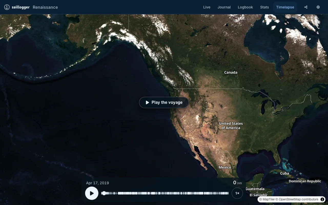
Watching
Your timelapse is at saillogger.com/app/timelapse, and Timelapse in the navigation. Play the voyage starts it.
Along the bottom:
- play, pause and, at the end, replay
- a scrubber you can drag to any point, with a tick where each trip begins
- the date you are watching, and a distance that counts up as the boat runs, in your own units
Down the side:
- Satellite imagery or the Marine chart, one press apart
- + and - to zoom. A pinch or the mouse wheel does the same, and the camera stays with the boat at your new scale
- Follow the boat, which appears once you pan away and brings the camera back
Captions fade in as the boat reaches them: the moorage you left, the moorage you arrived at, and your own notes wherever you attached one to a position. See Notes, photos and your journal.
Choose what plays
The button in the top left corner always says what is playing: All history, a year, or the dates you chose. Open it for Range:
- All history, the whole voyage.
- A tile for each of your years, saying how many trips and how far each one holds. Choose one and it starts playing straight away.
- Custom range, where you pick a span by Trips, with a Start trip and an End trip, or by Dates, with a Start date and an End date. Check the preview line, then Play range.
All history is always the way back.
If it does not look right
- Nothing plays. The chosen range holds no logged trips. Widen it, or go back to All history.
- The boat runs off the edge. Zoom out a step, or press Follow the boat.
- The track is hard to see. Switch between Satellite imagery and the Marine chart.
Share a timelapse
The Share button sits beside the range pill and hands over the range you are watching: pick a season and that season is what plays for the person you send it to, starting and ending where yours does. All history sends the whole voyage.
Sharing needs Timelapse switched on in your Sharing settings. If it is off, the button tells you the page is not public and offers Go to Sharing settings so you can turn it on. Turning it on publishes your timelapse at your boat's public address; it does not publish anything else.
Save it as a video
Next to Share sits Save video: it turns the range you are watching, whatever the button in the top left corner says, into an MP4 file you can post or keep.
Pressing it opens Save as video, which first checks your range and restates it: how many trips, how far, and the dates. Then choose how the video should look:
- Map:
Satellite Overlay,SatelliteorStreet Map. These are the video's own map styles rather than a capture of the chart on your screen. - Track color: eight colours, as swatches. Pick one that stands out against the map you chose, because a dark track disappears over deep water.
- Framing: how close the camera stays to the boat.
Closefor a day sail,Standardfor a cruise,Widefor a season,Oceanfor a passage. Saillogger suggests one from the distance of your range; change it if you want a different feel. - Place names: leave on for moorage-name captions, or switch off for a clean chart.
Press Save video at the bottom of the panel and Saillogger takes it from there: the video renders in the cloud, portrait and sized for social feeds, and you land on the Videos screen. You can close the app; rendering continues without you, and a notification on the bell tells you when it is ready to download.
If your range is too long for one video, the panel says so before anything is queued: press Change range, narrow it, and save the voyage in parts.
The Videos screen
saillogger.com/app/timelapse/videos lists your videos with live status: Queued with how many are ahead of yours, Processing with roughly how long is left, then Ready with the file size. Press Download to save the file. The page updates itself.
Export your tracks as GPX
saillogger.com/timelapse/export/ gives you a GPX file for a chosen range of trips. GPX opens in chart plotters and most navigation software, so this is the way to take your tracks somewhere else, or to keep a copy of your own.
- Choose Trips, a switch, with Start Trip and End Trip when it is on. Off means everything you have logged.
- Granularity: how many points the file holds.
Extremely Granular,Very Granular,Granular,Normal(the default),Coarse,Very CoarseorExtremely Coarse. Coarser means fewer points and a smaller file. - Export to download it.
Start at Normal. Go finer if you want every turn of a harbour approach, and coarser if the file is too big for the device you are loading it onto: some older chart plotters refuse a track with too many points.